Photo Gallery
What FOR Is Doing
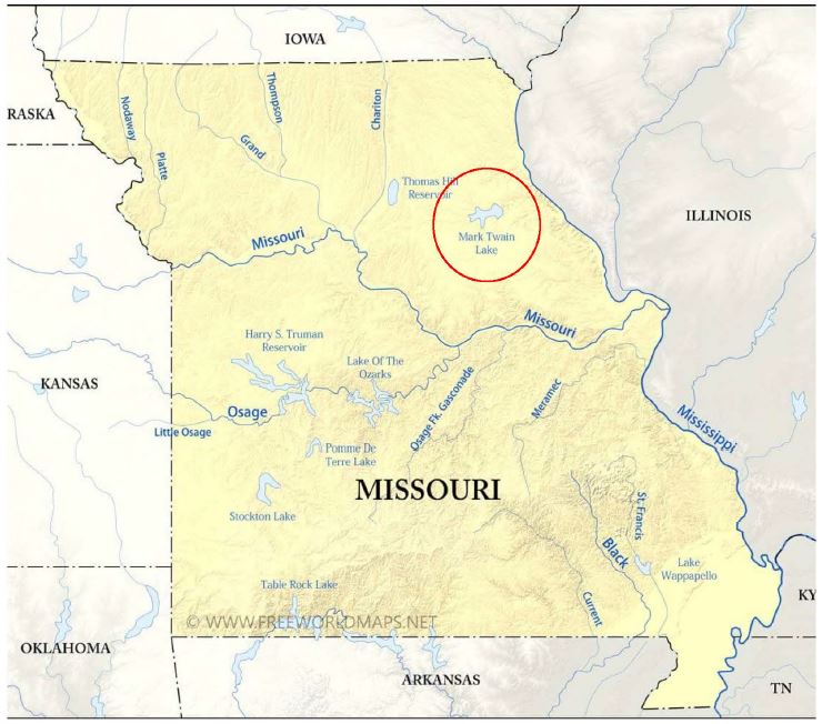
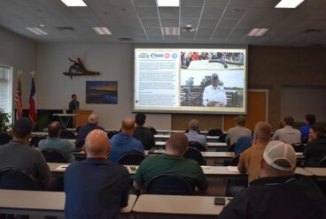
In May 2020, a consortium of resource professionals, tournament fisherman, recreational anglers, and community members was formed to develop a long-term fisheries habitat development plan for Mark Twain Lake. The members assessed current lake conditions, existing habitat structure, capabilities of independent entities, available resources, existing facilities, and the alignment of long-term goals.
Subsequent communication and collaboration yielded an initial five year management plan to establish artificial fisheries habitat at areas deemed imperative for implementation. The corporate goal of the plan is to establish new artificial habitat replacing the natural habitat which has deteriorated through the natural maturation process, or through the authorized operational requirements imposed upon the reservoir.
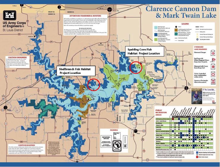
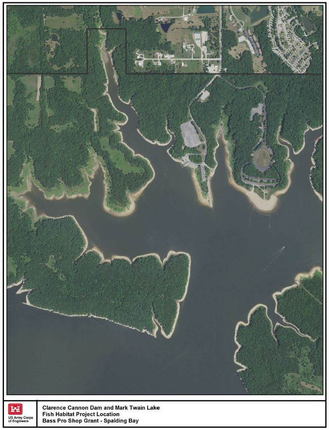
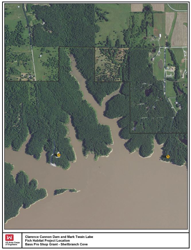
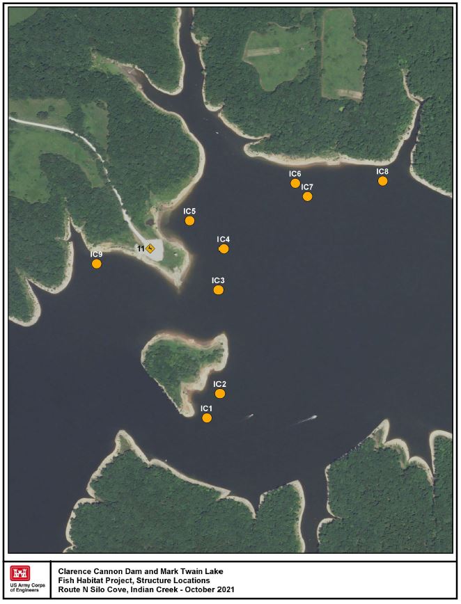
This project proposes the installation of artificial structure at two locations to restore approximately 60 acres of underwater fisheries habitat. The artificial structures are constructed of PVC materials and concrete that provide long-term durability, capable of withstanding the stresses of submerged and dry environments and designed to reduce snagging of traditional fishing tackle and equipment. The structures are placed at differing elevations in the basin of reservoir in a pattern to provide for stability and integrity of development. Furthermore, this project incorporates development of direct shoreline access to the restoration site which appeals to a broad demographic, including families, youth, senior citizens, and novice anglers. Though designed and placed as a shoreline fishing resource, the developed sites are still accessible to anglers conveying by boat.
The artificial structures utilized in this habitat restoration project are designed to replicate natural features and residual cover in the reservoir basin, and have been proven to be effective in providing structure for warm water fisheries at Mark Twain Lake. The following are the two structures that will be utilized in the project:
- Mark Twain Lake Cubes – 200 “MTL Cubes”, each measuring 5’ in height, 4’ in width, and 4’ in breadth are placed in deeper pool elevations. The cubes are constructed of 1 ½ inch PVC drain pipe and are intertwined with 100 feet of 4 inch drain tile tubing. The cubes are designed to standards proven to be effective in accommodating diverse species of game fish that suspend in differing depths and provide habitat at varying lake levels. These structures are placed in mass, generally 8 – 10 structures per site, with 10 – 12 sites established within the bounds of a bay or cove.
- Spider Blocks – 400 Spider Blocks are constructed for placement at the restoration sites. A standard 9” x 9” x 15”, dual cavity concrete block serves as the foundation of the feature. Concrete is placed in the cavities to secure ½ inch flexible irrigation tube serving as habitat structure. These structures are distributed in mass, generally 30 per site, with 6 -8 sites established within the bounds of a bay or cover. The blocks are placed at shallow depths in proximity to the shoreline providing littoral zone habitat favored by certain species of game fish, while also providing accessibility to shoreline fishing and vessel-oriented angling experiences.
Related News
Fish Habitat Restoration in the White River Chain of Lakes
Big congratulations to the NWA Fish Habitat Alliance for their feature in FishSens Magazine, highlighting their great work in Beaver, Bull Shoals, and Norfork Lakes! We are proud to call […]
Call for Presentations at the Annual Meeting
Submit your abstracts now for presentation at the 2026 Annual Meeting of Friends of Reservoirs/Reservoir Fisheries Habitat Partnership. We would like to especially emphasize any work (best practices, lessons learned, […]
Funding Opportunity: Kansas Reservoir Protection Initiative
An initiative which provides financial assistance to landowners in priority watersheds to implement sediment-reducing conservation practices to enhance sediment reduction efforts above federal reservoirs where water supply storage is impacted […]