| Entry ID | 2676 | ||||||||||||||
|---|---|---|---|---|---|---|---|---|---|---|---|---|---|---|---|
| Name of Applicant Organization (if applicable) | US Army Corps of Engineers, Rend Lake | ||||||||||||||
| Address of Applicant Organization | 11981 Rend City Road Benton, IL 62812 Map It | ||||||||||||||
| Project Leader | Cassie Magsig | ||||||||||||||
| Project Leader Address | 11981 Rend City Road Benton 62812 Map It | ||||||||||||||
| Project Leader Phone | (618) 724-2493 | ||||||||||||||
| Project Leader Email | Email hidden; Javascript is required. | ||||||||||||||
| FOR Member/Group Sponsoring the Project | Sesser-Valier Outdoorsmen Club | ||||||||||||||
| Reservoir Name | Rend Lake | ||||||||||||||
| Project Title | Rend Lake Native Habitat Improvement and Shoreline Erosion Prevention | ||||||||||||||
| Google Maps Location | 38°06'30.67" N 88°58'21.80" W | ||||||||||||||
| Map of Reservoir (Required) | 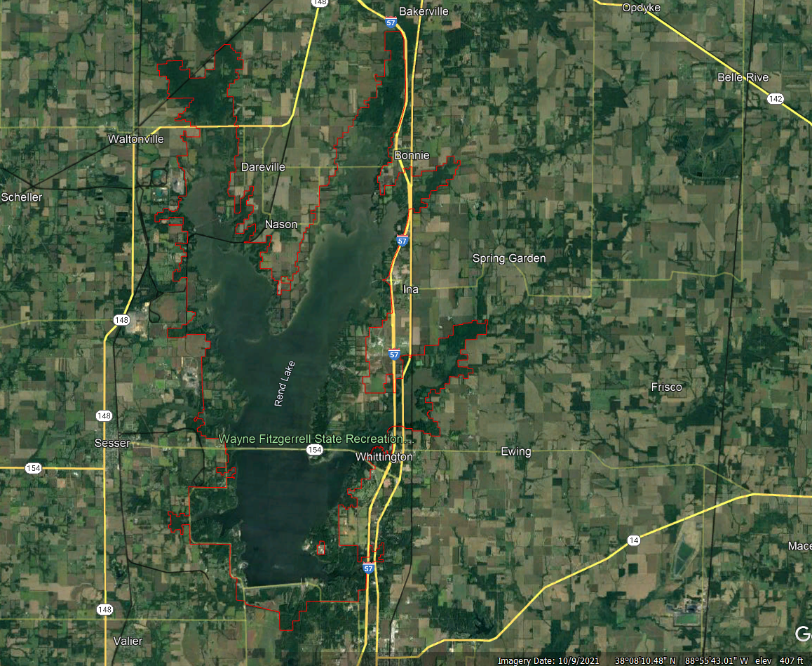 | ||||||||||||||
| In which region is the reservoir located? | Temperate Plains (TPL) | ||||||||||||||
| U.S. Congressional District | IL Congressional District 12 | ||||||||||||||
| Project Objectives | This project is proposed to create biological habitat, inhibit shoreline erosion on highly eroded areas, inhibit mobilization of sediment and nutrients, and reintroduce native plants to an area invaded by common reed. The benefits expected include: increased complexity and diversity of habitat for fish and other wildlife, decreased turbidity, siltation, and nutrient loading for improved water quality, increase of native plant species, and the protection of infrastructure necessary for the outdoor recreators to Rend Lake and its surrounding communities. This will promote increased density of priority game fishes and other desirable organisms for greater quality of experiences for anglers, campers, and other outdoor enthusiasts. This improvement project will also increase tourism dollars spent in the surrounding communities. | ||||||||||||||
| Priority Impairments addressed by the project: |
| ||||||||||||||
| Target Fish Species addressed by the project: |
| ||||||||||||||
| On-the-ground Start Date | 04/01/2023 | ||||||||||||||
| On-the-ground End Date | 09/30/2024 | ||||||||||||||
| Amount of Grant Request | $40,000 | ||||||||||||||
| Amount of Non-Federal Funding | 56,288.64 | ||||||||||||||
| Total Estimated Project Cost | 706288.64 | ||||||||||||||
| Project Overview | Rend Lake is a U.S. Army Corps of Engineers (USACE) reservoir located in Jefferson and Franklin Counties of southern Illinois. The Rend Lake dam is located on the Big Muddy River, 103.7 miles upstream from in confluence with the Mississippi River. At normal pool (405.0 feet), Rend Lake has a surface area of 20,633 acres, a maximum depth of 35 feet, and a mean depth of 10 feet. The lake is thirteen miles long and three miles wide and has 162 miles of shoreline. It is the second largest impoundment in Illinois. The Rend Lake project contains 53 recreation areas, with 756 campsites, 104 picnic sites, 30 boat ramps, 235 marina slips, and over 34 miles of trails. Nearly 2 million people visit Rend Lake annually, generating on average $35M in visitor spending within 30-miles of the project. Rend Lake's missions include flood risk management, water supply, water quality, fish and wildlife conservation, recreation, and area redevelopment. | ||||||||||||||
| Project Methods | Rend Lake USACE will be using federal funding and help from multiple partners to protect shoreline, create habitat, fight invasive species, and promote healthy fish populations. In previous years, shoreline protection involved placing large rock directly onto the eroding slope. After learning how other locations are creating rock dikes along the base of their shoreline, above the normal wave action line, to allow for natural sluffing and to create natural habitat, we decided this was the best solution for our shoreline with the most extreme slopes. Three of the worst areas, with the most to protect, add up to over 1300 feet of shoreline. These areas fall near or within recreation areas and are used by campers, boaters, and anglers all year long. Without the addition of rock, several campsites and part of the roadways will soon disappear into the lake taking away from outdoor experiences and tourism dollars. One of these areas also contain a large amount of cultural resources that need to be protected. Using federal funds, over 4000 lbs of 400 lbs rip rap will be added to the base of the shoreline in the fall of 2023. In 2024, in partnership with the Southern IL Wildlife Association and the Rend Lake Sportsmen’s Alliance, 60 container Bald Cypress trees will be planted behind the rock along the shoreline to provide additional shoreline stabilization and habitat for aquatic life. A local eagle scout and volunteers will assist USACE and the IDNR in planting appropriate aquatic and wetland native species plugs along 30,000ft2 section of shoreline. | ||||||||||||||
| Monitoring Plan | Success of the project will be gauged primarily by the bank stabilization, reduction of common reed, and native plant expansion outside of the planting area, and secondarily by fish response to the restoration areas. IDNR fisheries biologist will continue to conduct annual fall standardized fish population surveys and fall annual stocking success surveys to evaluate changes in the fish populations. The surveys provide data such as density, size, and body condition. Species evaluated would include largemouth bass, crappie, bluegill, catfish, striped bass hybrids, and white bass. Please see the 2023 Fisheries Fact Sheet attached. The IDNR and USACE have also surveyed the artificial structures placed recently, finding that they are heavily used. The IDNR will continue to perform their surveys and take note of newly restored areas for comparison from the past and into the future. | ||||||||||||||
| Outreach Plan | Signage listing the major contributors making the habitat restoration possible will be displayed at the Jackie Branch Boat Ramp and along the shoreline of the other shoreline project areas. Contributors include: USACE, IDNR, Southern IL Wildlife Association, Rend Lake Sportsmen’s Association, Multiple Eagle Scouts/Troops, Sesser-Valier Outdoorsmen Club, Friends of Reservoirs, and Reservoir Fish Habitat Partnership. | ||||||||||||||
| Please list the project deliverables (with quantities whenever possible). |
| ||||||||||||||
| Will the project deliverables have an impact on potential climate effects on reservoir habitat conditions? | Yes | ||||||||||||||
| Will state agency staff be involved in the project? | Yes | ||||||||||||||
| State Agency Involvement | IL Department of Natural Resources | ||||||||||||||
| Agency Letters of Support and Plans | Letter-of-Support-Signed-Feb-2022.pdf | ||||||||||||||
| Does the project involve one or more youth groups? | Yes | ||||||||||||||
| Please list all partners involved in the project: |
| ||||||||||||||
| Some folks are having issues with the above table. If you have any issues whatsoever, please upload your partner list here. | Cost-Estimate-Chart-for-FOR-application-2023.xlsx | ||||||||||||||
| Budget Narrative | The FOR grant funds (requesting $40,000) would be used to purchase the native aquatic and wetland plant plugs and a portion of the container Bald Cypress trees to plant in conjunction with trees donated and planted by Southern IL Wildlife Association and the Rend Lake Sportsmen’s Association, using their labor and vessels. The IL Department of Natural Resources will continue to survey the lake and will assist USACE with leading this project. The IDNR will provide standards and expertise on what type of plants and how/when to conduct the planting. They will be the main source for monitoring and providing evaluation measures and results USACE is funding the purchase and placement of 4000 lbs of large rock and aerial spray the common reed (both performed via contracts and totaling $610,000) along with labor to coordinate this project and assist with planting the plugs ($70,000). RCWMA has provided thousands in leveraged dollars towards the eradication project thus far and we estimate another $4,000 specifically for the Jackie Branch cove area, assisting with the follow up sprays and the follow up flyover to map the areas. The local eagle scouts and outdoorsmen club members are estimated to provide a total of $22,722.24 though labor and some supply of the native plants (purchased through money fundraised by the eagle scouts) to cover 70,000sf2 of bank shoreline. | ||||||||||||||
| FiscalYear | 2024 |
Large Grant Review