Chapter 3 : Sedimentation
- 3.1 Introduction
- 3.2 Sources of Sediment
- 3.3 Stages in Reservoir Sedimentation
- 3.4 Rates of Sedimentation
- 3.5 Effects of Sedimentation
- 3.6 Monitoring Sedimentation
- 3.7. Managing Sedimentation
3.1 Introduction

Sedimentation is a natural process in all water bodies. Sedimentation is relatively higher in reservoirs than in other water bodies because reservoirs impound a large volume relative to the area of their watershed. Sediment accumulation is accelerated by inadequate land-use practices that liberate soils, by the conversion of land into urban and suburban development that hastens runoff, or both. The rivers and streams deposit their sediment loads in the calmer waters of reservoirs, where sediment accumulation can have negative effects. Infilling with sediment can decrease water storage capacity and reduce the benefits of storing water in reservoirs. Shallower waters also may decrease the recreational value of a reservoir and the loss of access to parts of the upper reaches and embayments. Sedimentation also can result in the loss of habitat for fish, and sediment can carry pollutants including nutrients, which may act as catalysts for eutrophication.
Reservoir sedimentation can change physical, chemical, and biological components of the ecosystem, which results in the degradation of beneficial uses such as drinking water supplies, navigation, electricity production, flood control, and recreation (Figure 3.1). Eventually the reservoir may have to be abandoned. In the USA more than 3,000 such dams have been retired (Marsh 2005). The effects of deposited sediment delivered from watersheds can have severe economic costs for downstream residents and may decrease property values for lakefront properties and those properties near the reservoir.
Sedimentation is a major issue in many reservoirs in the USA. A survey of reservoir managers identified that approximately 28% of reservoirs >250 ac in the USA were of moderate-to-high or high concern relative to sedimentation (Krogman and Mi- randa 2016). These percentages vary regionally; for example, sedimentation afflicts as many as 51% of reservoirs in regions along the plains in the central USA. This same survey identified various correlations between sedimentation and both watershed and in-lake characteristics, particularly turbidity and loss of shallow reservoir habitats (Table 3.1).
Table 3.1. Spearman correlations (rs) between sedimentation and various watershed and in-lake characteristics. All correlations are statistically significant (P < 0.01; N = 1,271 reservoirs).Variable | Description | rs |
Harmful levels of agriculture | Watershed around the reservoir has adverse row-crop agriculture practices | 0.54 |
Harmful levels of livestock | Watershed around the reservoir has adverse grazing practices and/or feedlot production | 0.45 |
Disturbances in upstream watersheds | Disturbances in watersheds upstream of the reservoir (not around) impairs habitat | 0.55 |
Lack of connectivity due to sedimentation | Sedimentation has decreased connectivity to tributaries during low flow, acting as a barrier to fish movement | 0.49 |
Shoreline erosion | Removal of soil and terrestrial vegetation from the land–water interface resulting from weathering of banks or adjacent land slopes by water, ice, wind, or other | 0.63 |
Shoreline homogenization | A reduction of the shoreline's original habitat diversity by erosion or other processes | 0.52 |
Homogenization of littoral substrates | A reduction of the substrate's original diversity by erosion and sedimentation | 0.63 |
Excessively shallow | Reservoir is excessively shallow with no or few deep water refuges | 0.54 |
Excessive mudflats | Seasonally flooded and exposed expansive soft sediment present; terrestrial vegetation seldom grows unless mudflats are exposed for many months | 0.55 |
Excessively shallow littoral zone | Littoral zone is mostly shallow and heavily influenced by temperature, wind, and other atmospheric changes | 0.56 |
Excessive nutrients | Excessive nutrients, primarily nitrogen or phosphorous, that may increase primary production and lead to excessive plant growth and decay and, lack of oxygen | 0.55 |
Excessive suspended sedi- ment or inorganic turbidity | Particulate inorganic matter and fine sediment in the water column that may inhibit primary production or foraging by fish and other aquatic organisms | 0.72 |
Excessive organic turbidity | Particulate organic matter, other than algal blooms, suspended in the water column | 0.56 |
Loss of cove habitat due to sedimentation | Sedimentation has changed cove habitat, including reduced surface area, fragmentation, and establishment of terrestrial vegetation in newly deposited land | 0.73 |
3.2 Sources of Sediment
Reservoir sedimentation begins with soil erosion caused by rain and wind and with runoff that transports sediment particles into streams (Novotny and Olem 1994). Depending on composition, various types of land cover produce different runoff characteristics. Determining sediment sources is essential for designing cost-effective sediment management strategies that will achieve meaningful reductions in sediment loads and yields (Walling 2005). Overall, the sediment entering reservoirs originates from erosion of four general sources: (1) soil from overland flow, including farmed areas in the watershed; (2) streambank and channel erosion, including channel migra- tion, bank widening, and avulsion; (3) remobilization of stored sediment through channel processes acting on floodplains or other storage sites; and (4) erosion of shorelines and shallow-water areas by wave action.
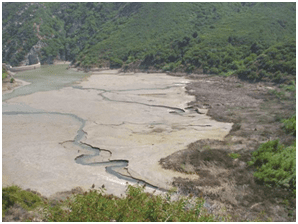
Streamflow slows as it enters a reservoir, and suspended particles begin to settle out. Eventually, most sediment will settle to the bottom of the reservoir, but heavier sediment particles are deposited first. Sedimentation does not occur uniformly; it is affected by many factors including the flow and volume of water produced by the incoming stream and the size and weight of sediment particles. The coarser portion of the inflowing sediment load is deposited where the main tributary and minor tributaries to embayments enter the reservoir. There, the tributaries form delta deposits that deplete reservoir storage, cause channel aggradation extending miles up- stream from the reservoir, and fill in shallow coves and embayments that often represent some of the most diverse fish habitats in the reservoir (Williams 1991). Channel aggradation can change flood patterns and floodplain configuration upstream. If delta areas become heavily vegetated, the upstream flood levels can be elevated further be- cause of increased hydraulic roughness, and the vegetation can trap sediment, thereby promoting additional aggradation (James and Barko 1990). In arid zones the transpiration from large areas of vegetation in delta areas can increase water losses from the reservoir significantly. For example, evaporative losses from the delta of Elephant Butte Reservoir on the Rio Grande in New Mexico were estimated at 140,000 ac-ft/year before they were reduced by 66,000 ac-ft/year by the construction of a low-flow conveyance channel through the delta in 1951 (BOR 2007).
The nature of the sediment accumulated in a reservoir depends on geology, topography, soil, and climatic conditions. Where parent materials in the watershed are shales or limestone, sand content of sediment is low. Where parent material is mainly sandstone, sand content may be high. Some igneous and metamorphic rocks produce fine sediment under some climatic conditions and coarse material under others. For example, sediment derived from Piedmont areas in the southeastern USA contains proportionally large amounts of clay and colloidal material. Sediment derived from loess-type soils in the Midwest has high silt content. The Cross Timbers area of Texas, with sandy soils and poorly consolidated sandstone substrata, provides sediment with high sand content. Environmental origin has a definite bearing on watershed sediment yield, transport, and deposition in a reservoir, and the nature of the sediment has a direct bearing on the percentage of total load deposited in the reservoir and on the ultimate volume of deposited material.
A river can carry sediment into a reservoir in two distinct modes: bedload and suspended particles. In bedload transport, the sediment particles move by rolling or sliding or through jumps the length of a few grain sizes (known as saltation), and they are thus in frequent contact with the channel bed. In suspended load transport, the weight of the particles is supported by turbulent forces in the water, and they can travel considerable distances without coming into contact with the bed. The total load is the sum of suspended load and bedload. Whether an individual particle is trans- ported as suspended load or as bedload depends on particle size, weight, and shape and on hydraulic conditions. Whereas the bedload is often deposited in the upper end of reservoirs or the upper end of embayments, depending on current suspended loads can move farther into the reservoir. This fraction does not easily sink in the water column, and slight turbulent forces keep it in suspension for long periods. In rare in- stances, light dispersive colloidal clays delivered in suspended loads never settle out and remain in suspension aided by minimal wind-generated wave energy. In reservoirs, besides river inputs, fine suspended material originates from shoreline erosion and organic and inorganic material generated within the reservoir by biological activity. In eutrophic waters the latter source can be quite significant. Fine material can be resuspended repeatedly by currents and wave action until it eventually is deposited in an area where water movements are insufficient to resuspend or remobilize it.
Back to top
3.3 Stages in Reservoir Sedimentation
Most natural river reaches are roughly balanced with respect to sediment in- flow and outflow. Sediment may accumulate temporarily in some channel reaches but is mobilized and transported downstream by large flow events. No river reach is ever completely balanced with respect to sediment. Some reaches may experience long- term cycles of aggradation (increase in land elevation due to the deposition of sediment) and degradation (decrease in channel elevation due to erosion of the streambed) over time scales of centuries. Overall, the total amount of sediment transported through a reach is much larger than the rate of aggradation or degradation within the reach.

Dam construction dramatically alters this balance, converting the flowing stream into a pool characterized by low velocity and efficient sediment trapping. Coarse bed material loads are deposited as soon as stream velocity diminishes as a result of backwater from the dam, creating delta deposits at points of tributary in-flow (Figure 3.2). Fine sediment is carried farther into the reservoir and accumulates downstream of the delta deposits. These fine sediments are deposited across the width of the reservoir. The slowed flows lose the ability to transport sediment, but wave energy can remobilize sediment or erode reservoir shorelines. Because reservoirs, with frequently changing water levels, rarely establish littoral zones stabilized by aquatic or terrestrial vegetation, their shorelines are especially vulnerable to erosion and transport of sediment. Over long periods, the impounded reach will accumulate sediment and lose storage capacity until a sediment balance is again achieved. This would normally occur after the impoundment has become filled with sediment and can no longer provide water storage and lacustrine benefits.
In advanced stages of sedimentation, the reservoir, or embayments within the reservoir, transition from continuous deposition to a mixed regime of deposition and scour, and the rates of sediment deposition are reduced compared with earlier stages when sediment trapping was continuous. In wide reservoirs, this stage is also characterized by the transition of sediment deposits from horizontal beds to a channel–flood- plain configuration. This transition will occur naturally when sedimentation reaches the spillway crest; a main channel will be maintained by scour, and its base level will be established by the spillway. Sediment deposition continues on floodplain areas on either side of the channel, causing the floodplain elevation to rise above the spillway elevation (Figure 3.1). In narrow reaches, the scour channel may occupy the entire reservoir width and the floodplain may be absent.
Some older reservoirs have received substantial loads of sediment and are beginning to show advanced stages of sedimentation in their upper end and entrance to embayments. One example is Lake Texoma reservoir, Oklahoma–Texas. Patton and Lyday (2008) reported that extensive sedimentation and aggradation of sediment above water level effectively reduced reservoir area and led to embayment isolation, fragmentation of lacustrine habitats, morphometric changes, and establishment of terrestrial vegetation on newly emerged lands (Figure 3.3). Sedimentation led to the development of linear bars of deposition above normal pool elevation that have blocked mouths of embayments, bisected large areas of the reservoir, and fragmented several pools. Sedimented areas exhibited lower gradients and reduced habitat heterogeneity. The shorelines affected by sedimentation were homogenized and of low quality for all but a few species of fish, and their shallow nature made them especially susceptible to drying from even minor water-level reductions. Fish assemblages in isolated reservoir fragments appeared to be distinct from fish assemblages in nonfragmented habitats.
This change in community structure conceivably was driven by a reduction of pelagic species from fragmented sites, as these sites had limited or no connectivity to the main body of the reservoir.

3.4 Rates of Sedimentation
Rates of reservoir sedimentation vary according to location of a reservoir within an impounded river basin. Upstream locations that are the outlets of small watersheds have different sediment yields than do downstream locations that are the outlets of larger watersheds. The sediment delivery ratio is the ratio between the amount of sediment produced from the surfaces in a watershed and the amount yielded at its outflow point (Neuendorf et al. 2005). This delivery ratio becomes progressively smaller for increasingly large watersheds. Generally, with all other factors being equal, the larger the watershed, the greater the internal storage of sediment (Graf et al. 2010). Thus, downstream reservoirs receive proportionally less sediment with respect to their drainage areas. This generalization does not hold true, however, if all other factors are not equal. For example, if major sediment-producing areas with highly erodible geologic materials are located low in the basin, low-basin reservoirs are likely to receive larger amounts of sediment. Variability in sediment contributions to downstream reservoirs is likely to result from regional climatic, geological, and land-use distribution.
Storms deliver large amounts of water to a river and downstream reservoir and potentially large loads of sediment. Fast-moving and high-flowing water can pick up, suspend, and move larger particles more easily than slow-moving normal flows (Olive and Rieger 1985). In fact, so much sediment can be carried during large storms that a high percentage of all the sediment moved during a year might be transported during a single storm period.
Data for rates of sedimentation in reservoirs of the Missouri River system exemplify the influence of scale and location in a drainage basin. The U.S. Army Corps of Engineers (USACE) has constructed six main-stem reservoirs and 16 additional reservoirs on tributaries. Sediment surveys have been conducted to define annual rates of storage loss through sedimentation for many of these reservoirs. The reservoirs with the highest rates of sedimentation were in small tributary streams, particularly in the Kansas and Osage river basins, where they receive runoff from drainage areas with high sediment yields. There are exceptions to this generalization, including the case of Lewis and Clark Lake reservoir on the Missouri River, which has lost more than 20% of its storage capacity resulting from sedimentation. This reservoir is at the down- stream end of a series of six large reservoirs, so it receives little sediment influx from the Missouri River. Its primary source of sediment is the Niobrara River, a direct tributary to the reservoir. A similar example is Elephant Butte Reservoir on the Rio Grande in New Mexico. Although it is on the main-stem river, downstream from several other reservoirs, it has a very high sedimentation rate because it collects sediment from highly erodible basins drained by the Rio Puerco and Rio Salado rivers (Scurlock 1998).

The amount of sediment entering reservoirs responds to controlling factors that change over time as well as space. The primary controls on temporal change in reservoir sedimentation rates include climate, land use, geologic materials, fluvial system operation, and minor influences that may be locally or temporarily important. Geographical climate variation is especially important in the interior USA. Tucker et al. (2006) demonstrated that on the Great Plains the episodic timing of erosion and sediment yield were caused by climate oscillations between drought and wet decades. Based on nationwide data available in the Reservoir Sedimentation Survey Information System database, Graf et al. (2010) mapped mean annual loss of reservoir capacity through sedimentation. Mean annual loss ranged from <0.4% to >2%. A distinct national pattern was evident (Figure 3.4). The lowest sedimentation rates occurred in reservoirs of the Northeast and Tennessee Valley. The highest rates occurred in arid portions of the Columbia, Lower Colorado, Missouri, and Rio Grande rivers. High rates of sedimentation were also observed in the Lower Mississippi River basin.
No broad guidelines are available as to what are acceptable sedimentation rates. In Nebraska, the Department of Environmental Quality adopted methods to evaluate the severity of sedimentation in reservoirs (NDEQ 2008). This methodology uses the average annual loss of a reservoir’s original conservation pool to index severity. Four volume-loss categories were defined for assessment purposes: substantial >0.75%, moderate >0.50% to <0.75%, slight >0.25% to <0.50%, and minimal <0.25%. These criteria are also used as the basis for placing reservoirs on Nebraska's Department of Environmental Quality Section 303(d) list for sedimentation. Any reservoir with average annual volume loss ≥0.75% falls into the "substantial" category and is placed on the Section 303(d) list. Although the volume loss cutoff of 0.75% is used to determine degradation, sedimentation goals for reservoir projects may need to be much more aggressive. Moreover, these guidelines may need to be modified geographically depending on local conditions.
Back to top
3.5 Effects of Sedimentation
Bottom sediment is a critical component of reservoir systems. Sediment serves as habitat for benthic invertebrates (Peeters et al. 2004); can influence macrophyte distribution (Duarte and Kalff 1986); accumulates nutrients and regulate nutrient recycling rates (Søndergaard et al. 2003); controls concentrations of dissolved oxygen, hydrogen sulfide, and other constituents in bottom waters (Miranda et al. 2001; Reese et al. 2008); accumulates contaminants such as metals, pesticides, and other hydrophobic organic compounds (Karickhoff et al. 1979; Baudo et al. 1989); and provides a record of past conditions in the reservoir and its watershed (Wren et al. 2008). Sedimentation can clog interstices in substrate, thus reducing sediment–water exchanges and oxygen penetration and altering biogeochemical and microbial processes (Rehg et al. 2005; Nogaro et al. 2006). A large fraction of the nutrients deposited into a reservoir are stored within layers of sediment attached to organic and clay particles (Nürnberg 1988). Deposition of phosphorus bound to clays can play a large role in a reservoir’s oxygen budget, particularly after the reservoir has lost depth. The interactions among the mineral properties of sediment and water chemistry determine whether sediment becomes a source or a sink of nutrients or other contaminants. Periodic anoxia in the hypolimnion can, for example, result in desorption of nutrients or other contaminants from sediment into the water column (Søndergaard et al. 2001; section 6). Physical and chemical interactions between water and influent sediment can, therefore, play an important role in determining the outcome of the effects of increased sediment loading on lake ecosystems (Nürnberg 1988).
Benthic invertebrates play an important role in the food web of many reservoirs and in recycling of materials (Underwood 1991). Increased sedimentation, by increasing inorganic turbidity of the water column and rates of sedimentation of inorganic particles into the reservoir basin, has a number of direct and indirect effects on benthic invertebrates, including reduced feeding and growth rates and increased mortality (Donohue and Irvine 2003). Sediment loading tends to reduce the abundance of benthic invertebrates (Donohue and Irvine 2004). Moreover, alterations to benthic invertebrate taxonomic composition can occur (Carew et al. 2007). These alterations frequently include reductions in species richness resulting from increased homogeneity of substrates. Input of fine sediment has been reported to be more detrimental to benthic invertebrates than coarse sediment because it is more likely to clog interstices and reduce oxygen penetration.
Spawning habitat of substrate-spawning fish is smothered by sedimentation (Muncy et al. 1979). If sediment blankets the substrate after spawning, oxygen supply to eggs and sac fry is decreased because of reductions in water circulation (Waters 1995; Argent and Flebbe 1999). Consequently, sedimentation decreases available spawning habitat, reduces spawning activity, and increases egg and larval mortality (Alabaster and Lloyd 1982; Ryan 1991). Reproductive strategies that involve parental care, such as fin fanning and egg nipping and mouthing, appear to be more successful in habitats with intermediate levels of sediment (Berkman and Rabeni 1987).
In areas where sedimentation continues unabated, shallow aquatic habitats can transition relatively quickly to wetlands and eventually to uplands because of continued sediment deposition above the normal pool elevation during flood flows. Sedimentation of the littoral zone rather than the profundal zone, along with shore erosion, and reduced connectivity to embayment habitat through mouth sedimentation are likely to have the biggest effect on reservoir fish communities. Barren, homogeneous, windswept littoral areas are poor food producers, unsuitable habitat for nest builders, and poor refuges for littoral juvenile fishes. As the bank and littoral habitats degrade through sedimentation and erosion, and environmental conditions or reservoir operation prevent establishment of aquatic or wetland macrophytes, the density of fish that rely on the littoral zone during all or part of their ontogeny decreases. In such reservoirs, the fish community shifts toward dominance by species that can occupy pelagic niches and thus do not rely on substrates or substrate-based resources. Erosion and ensuing sedimentation and shallowing of reservoirs not only have been linked to reductions in benthic production but also to reductions in plankton production through reduced water clarity. In advanced stages of sedimentation, fish communities may consist of species that thrive in turbid, shallow systems with low oxygen and large fluctuations in temperature.
3.6 Monitoring Sedimentation
Various methods have been developed for estimating thickness of accumu- lated sediment in a reservoir. Three techniques are described here, including sediment cores, topographic contrast, and acoustic estimation. Each technique has limitations and strengths. Ideally, all three approaches may be applied concurrently to get a more complete representation and estimation of sediment thickness and distribution.
3.6.1 Sediment Cores
Cores typically are taken from a boat by means of a gravity corer or vibrational coring system. In either case, aluminum, plastic, or steel tubes are forced into the sediment, ideally until pre-impoundment substrate is reached. The tube is withdrawn and sliced longitudinally, or the sample is carefully removed from the tube, allowing for the measurement of sediment thickness and sample collection. The interface between pre-impoundment substrate and post-impoundment sediment is usually fairly distinct. Several companies manufacture sediment coring systems, including some small systems suitable for use in small boats in reservoirs (e.g., VibeCore Specialty Devices Inc., Wylie, Texas). A benefit of sediment cores is that they can be preserved and analyzed for sediment classification and chemical composition. However, core sampling and analysis is time and labor intensive.

3.6.2 Topography Contrast
This approach computes the difference between pre-impoundment and current bottom topography and creates a spatial representation of sedimentation (Figure 3.5). Data from pre-impoundment topographic surveys or reservoir blueprints are used to re-create a pre-impoundment surface, and data from recent bathymetric surveys are used to create a map of current reservoir bottom topography. Unlike spot sediment cores, topography contrast can represent sediment accumulations throughout a reservoir, facilitating estimates of sediment distribution and volume. The quality of data produced by this approach depends on quality of the pre-impoundment maps.

3.6.3 Acoustic Estimation
High-frequency and low-frequency transducers are operated simultaneously during a survey conducted from a boat (Anderson and Pacheco 2011). Differencing acoustic returns from high and low frequencies (reflecting off the current reservoir bottom and the pre-impoundment bottom, respectively) have shown promise for successfully mapping sediment thickness in inland reservoirs. Mapping the base of sediment acoustically may work best in reservoirs dominated by fine sediment (clay and silt rather than silt and sand), as illustrated in Figure 3.6. Reservoirs with fine-grain deposition do not form significant deltas at tributary inlets. Coarse- grain-dominated reservoirs fill from the tributaries toward the dam and form deltas in their tributaries; therefore sediment may be surfacing and difficult to map unless water level is raised. In these cases the topography contrast method may be more appropriate.
3.7 Managing Sedimentation
Reservoir sedimentation management strategies can include one or more of the following techniques (Palmieri et al. 2003; Morris 2015): reducing sediment inflows, managing sediment once in the reservoir, and removing sediment accumulated in the reservoir. Successful sedimentation management may employ a combination of strategies, which may change over time as sedimentation becomes more advanced (Morris 2015).
The solution to external sedimentation problems is to control soil erosion in the watershed (section 2). However, controlling all soil erosion is not possible. Conservation farming practices significantly reduce amounts of sediment produced, although the sediment that is produced is of smaller particle size, which can efficiently carry some nutrients and chemicals. Additionally, streambank erosion is a source of sediment that is not easily controlled. Western parts of the USA also experience high rates of “geologic” erosion on lands that are not cultivated or disturbed by human activities. The Badlands of South Dakota are an example of very high natural geologic, or back- ground, erosion rates.
Current management efforts focus on reducing sediment inputs from the watershed, streambanks, and streambeds. Much of the erosion from tillage practices has been greatly reduced since the 1970s, but there is a large amount of “legacy” material that has been deposited into stream channels and is now the primary source of sediment entering reservoirs in parts of the country, particularly the Midwest. It is also necessary to manage sediment already deposited in reservoirs. Reducing sediment will extend the useful life of reservoirs, reduce the amount of nutrients entering reservoirs, and improve water clarity and quality.
3.7.1 Reduction of Sediment Inflows
Methods applicable to the watershed to control sediment before water enters the reservoir include watershed management (section 2) and channel structures such as sediment basins and dikes.
3.7.1.1 Sediment basins
A sediment basin (also referred to as a sediment trap, check dam, or detention basin) is an earthen or rock embankment suitably located to capture runoff and filter out sediment before they reach the reservoir (Figure 3.7). These basins alter the passage of flood waves, interrupt longitudinal movement of sediment, slow down turbulent flows into flows having lower energies, and may remove the majority of dense sediment within the water by settling (Boix-Fayos et al. 2008). Sediment basins are designed to provide an area for runoff to pool and settle out a portion of the sediment. Trapping efficiency is a function of sediment type and the ability of the basin to reduce the transport energy of the flows.

Basins may be dry or wet. Dry basins are empty most of the time but hold water for a few days during storm events. Detaining water for a few days allows settling of most of the sediment load (Cooke et al. 2005). Wet ponds retain a low volume most of the time and are often able to remove nutrients in addition to sediment. Because a permanent pool of water remains in a wet detention pond between storm events, microorganisms and algae flourish and provide additional removal of dissolved pollutants beyond that accomplished by sediment trapping (Harrell and Ranjithan 2003). Wet basins also can provide substantial aesthetic and recreational value and fish and wildlife habitat.
Sizing of the basin relative to the watershed is important. A ratio of pond volume to mean storm runoff volume of 2.5 potentially can remove about 75% of suspended solids and 50% of total phosphorus (Schueler 1987). The National Urban Runoff Program (Athayde et al. 1983) recommended a wet pond with a surface outlet, a mean depth of 3 ft, and a surface area ≥ 1% of the watershed area. Urban wet detention ponds sized at 1% of runoff area had removal of solids up to 70% and of total phosphorus up to 45% (Wu et al. 1996). A surface overflow outlet improves sediment capture as the outlet removes the cleanest water. A chain of ponds, emphasizing biological removal of nutrients in the terminal pond, was recommended by Walker (1987). All ponds may require a dense perimeter of bank vegetation to provide protection from shoreline erosion. One problem in sizing ponds is the "short-circuiting" that occurs when storm water passes through the pond with little or no displacement of pond water (Horner 1995). A minimum length to width of 3:1 may eliminate this problem (Schueler 1987), but topography may prevent this design, forcing the use of groynes in the pond to divert inflowing water into the entire pond. Specific guidelines for sizing are usually available from regional natural resources conservation services or engineering offices.
All sediment basins require regular maintenance to remove sediment and trapped debris. When possible, basins may be designed to be drained for excavation, which is less expensive than dredging. Techniques to make sediment removal easier are to construct an accessible forebay that retains the largest particles, build a ramp for small-dredge access, and establish a watershed area for sediment disposal (Schueler 1987). Mowing may also be necessary to limit woody vegetation growth.
The size of the sediment basin depends on the size of the watershed, extent and composition of sediment runoff, amount of precipitation, and efficiency of sedimentation of a target sediment grain size. Various rules of thumb are used, but generally the amount of precipitation is taken as the largest 1-year, 24-h precipitation event. Coarse-to-medium size silt particles will settle out quickly whereas finer particles (i.e., clay and fine silt) will require a long time to settle. Thus, sedimentation basins tend to remove a high percentage of coarse-to-medium particles but a small percentage of clay and fine silt particles unless the size ratio of the sedimentation basin to watershed is increased. Pairing sediment basins with wetland cells to trap and treat the nutrients associated with the smaller particles can be an effective practice.
3.7.1.2 Sediment dikes
Installed at the upper reaches of reservoirs to form marshes, dikes (also re- ported as subimpoundments) trap sediment and agricultural runoff as water enters the reservoir (Figure 3.8). These structures slow water velocity during runoff events, allowing sediment to settle out before the water reaches the main reservoir. The water behind a dike develops an extensive wetland that increases filtration of sediment while providing expanded habitat to fish species adapted to wetlands, as well as to shorebirds, waterfowl and fur- bearers. Sediment dikes and sediment basins serve the same purpose. Selection of one over the other often depends on site availability and ownership, access, hydrology, and potential for value added in terms of providing additional habitat for fish and wildlife.

These structures usually retain water above the normal operating level during reservoir drawdown periods, thereby creating small ponds or lakes. Besides trapping sediment, subimpoundments can contribute to natural resource management through the development and maintenance of wildlife habitats, wetlands, and dispersed recreation. While reservoir control authorities generally do not encourage the construction of subimpoundments, they will consider proposals from government agencies to provide public benefit. The Tennessee Valley Authority, for example, has worked with state and federal agencies to develop subimpoundments for natural resource management, such as those that create or enhance wildlife habitats.
A frequently used design is a notched, low-profile sediment dike spanning the width of a reservoir’s headwaters. Although the dike converts a portion of the reservoir from open water into a large sediment basin and wetland, the benefits to the reservoir can be substantial. Because the dike is notched, water levels behind the structure are maintained at normal lake elevation unless a high runoff event occurs. This means practically no flood storage loss occurs. However, to maintain dike function, sediment trapped in the areas isolated by sediment dikes may have to be dredged periodically.
3.7.1.3 Bypass channel
When topographic conditions are favorable, a large-capacity channel can be constructed to bypass sediment-laden flow around a reservoir. By routing the sediment around the reservoir into the tailwater, sediment accumulation of bedload and suspended load is reduced. However, transport capacity in bypass channels may be limited for coarse sediment loads. Construction of bypass channels has been restrained by the high cost of construction and maintenance. Such channels may eliminate the need to construct and maintain a large-capacity spillway at the main dam because flood flow is diverted, possibly compensating for the high cost of building a channel.
3.7.2 Sediment Management in the Reservoir
Techniques for preventing sediment from settling once water enters the reservoir include sluicing, density current venting, and bypassing the reservoir via a channel (section 3.7.1.3). A major disadvantage of these techniques is that a substantial volume of water must be released to transport sediment. Therefore, they may be most applicable in reservoirs for which the water discharged by large sediment-transporting floods exceeds reservoir capacity, making water available for sediment release without infringing on uses. Moreover, these techniques may not be able to remove previously deposited sediment or pass the coarsest part of the inflowing load beyond the dam. Reservoirs constructed and operated as managed systems for water supply, irrigation, hydropower generation, or flood water capture may not be able to use these techniques and have to either reduce sediment inflows or remove sediment after deposition.
3.7.2.1 Sluicing

Sluicing is an operational technique in which a substantial portion of the incoming sediment load moves through the reservoir and dam before sediment particles can settle (Figure 3.9), reducing the reservoir’s trap efficiency (ICOLD 1989; Morris and Fan 1998). In most cases, sluicing is accomplished by operating the reservoir at a lower level during the flood season to maintain higher flow velocity and sufficient sediment transport capacity of water flowing through the reservoir. Increased sediment transport capacity reduces the volume of deposited sediment. After flood season, the pool level in the reservoir is raised to store clearer water. Effectiveness of sluicing operations depends on availability of excess runoff, size of sediment, reservoir purpose, and reservoir morphology.
3.7.2.2 Density current venting
Density currents occur because the density of sediment-carrying water flowing into a reservoir may be greater than the density of clearer water already in a reservoir. The increased density, increased viscosity, and concomitant reduction in turbulence intensity result in a uniform current with high sediment concentration that dives underneath the clear water as it moves toward the dam. As the current travels downstream, it will generally deposit the coarser part of its sediment load along the bottom, and if enough load is deposited, the density current will dissipate along the way to the dam. If the current reaches the dam, it will accumulate to form a submerged “muddy lake,” and the turbid water reaching the dam can be vented through low-level outlets.
Several observable phenomena indicate the presence of turbid density currents in a reservoir. A muddy flow that enters and disappears at the upstream limit of a reservoir, a phenomenon frequently observed from the air, is an indication of plunging flow. The plunge line may be observed as a sharp transition between clear and turbid water and by the accumulation of floating debris. Continuous turbidity monitoring immediately above the reservoir and at the dam can indicate the presence of turbidity currents and also establish their travel time to the dam. Bottom water can be discharged continuously through a low-level outlet and monitored below the dam to observe the arrival of turbid water. The presence of density currents also may be measured by sonic or other velocity-profiling methods or by monitoring of water-quality variables such as temperature and dissolved oxygen, which distinguish the inflowing and impounded waters.
In reservoirs with known density currents, installation and operation of low- level gates allows sediment currents to pass through the dam for downstream discharge. Density current venting is an attractive option because, unlike flushing operations, it does not require lowering the reservoir level. This approach results in in- creased downstream sediment loads that can aggrade stream habitats or possibly enhance sediment-starved reaches below the dam.
3.7.3 Removal of Sediment from the Reservoir
Techniques for removing sediment once it has accumulated in a reservoir include mechanical removal (e.g., excavation, dredging, and hydrosuction), consolidation, flushing, and aeration. The best-suited application will depend on the ability to manage reservoir water levels. In many situations, lowering water levels to remove sediment is desirable because removal options are usually less expensive, sediment can be removed in a manner that creates habitat features that are beneficial for fish habitat, and sediment can be placed at specific spoil locations. Excavating sediment from existing reservoirs to return to preconstruction volumes can require moving more material than originally was moved to construct the dam embankment and can be cost prohibitive. Also, significant control of water levels at the appropriate time for removal or flushing may not be practical. Choosing the best option for a reservoir may include a combination of techniques applied to different locations. A number of environmental concerns are associated with sediment removal. Sediment removal rarely will be cost effective where high sedimentation rates prevail.

3.7.3.1 Excavation
Excavation requires temporarily lowering the reservoir water levels, working within seasonal drawdowns, or working when reduced river flows can be controlled adequately without interfering with excavation work. Large- scale removal of sediment is possible with commonly used earth-moving equipment and in a manner that benefits fish habitat through the creation of ledges, trenches, and drop-offs (Figure 3.10). These irregularities in a reservoir's basin attract and concentrate fish. In Nebraska, excavation of sediment averaged US$4–5/yd3 in 2014, although the cost went as high as $8. (M. Porath, Nebraska Game and Parks Commission, personal communication). This cost normally includes excavating, hauling to a designated spot (outside the basin) and dumping, and grading the dumped sediment. Distance hauled between the reservoir and spoil sites is the primary cost driver; therefore, nearby spoiling sites or spoiling within the basin (e.g., to create islands or other structures) may be a better option unless nutrient removal is also a goal. The cost cited usually does not include the cost to seed the spoil area or install and maintain soil erosion fencing (M. Porath, personal communication). Excavation and disposal costs can add up depending on the amount of sediment requiring excavation; therefore, this technique generally is used in relatively small reservoirs or in key embayments of large reservoirs.
Sediment spoil can be used to rebuild shorelines and create islands, if the sediment is not excessively nutrient rich and if it meets compaction standards for building in-lake structures. Shoreline erosion caused by wave action gradually enlarges reservoirs. However, the extra water created is shallow, absorbs the power of crashing waves, and supports few fish. By removing silt from areas close to shore and depositing it at the existing bank, deeper water more suitable for supporting fish can be created within casting distance of the bank. Sediment spoils excavated from the basin also can be relocated within the basin as islands if sediment is functional as per caveats listed. Creating islands creates more shoreline. Islands often are stabilized with rock riprap or other revetment materials to prevent bank erosion.
Depending on location, excavation can be costlier than dredging, but the comparative economics will depend on the job characteristics (Morris and Fan 1998). Excavation of dewatered sediment by means of heavy equipment and trucks eliminates the problem of dewatering the slurry generated by dredging, reduces sediment bulking compared with dredging, and can be used to deliver sediment to many small and widely dispersed containment or reuse sites. Environmental permitting requirements for excavation also may be simpler than those for dredging. Unit costs will vary widely and are region specific, depending on the volume of material, haul distance, and elevation difference between the points of excavation and disposal; the costs listed earlier for Nebraska are probably in the low end of the scale.

3.7.3.2 Dredging
The process of excavating deposited sediment from under water is termed dredging. This is a highly specialized activity used mostly for clearing navigation channels in ports, rivers, and estuaries. Dredging also can be used to reclaim reservoir storage capacity lost to sediment deposition and to open channels to restore connectivity with backwaters (section 9). However, dredging is often more expensive than excavation because of the amount of extra handling needed to move similar amounts of material. According to Hargrove et al. (2010) the cost of dredging ranges from $2.50 to $14.00/yd3. To put this into context, the 2010 cost for removing sediment from a 7,000-ac reservoir nearly filled with sediment would be about $1 billion (Hargrove et al. 2010). In addition, it would be necessary to clear and grub, haul, grade, and stabilize the spoil location. Ideally, a disposal location for the excavated material can be found close to the reservoir to reduce transportation costs. Costs associated with dredging are expected to vary widely geographically depending on a variety of local factors.
Smith et al. (2013) estimated the economics of dredging Tuttle Creek Lake, Kansas, versus implementation of cropland management strategies to reduce sediment runoff. They found that in this watershed if the marginal costs of agricultural best management practices (BMPs) implementation exceeded $6.90/t of sediment reduction, then dredging would become the economically preferred alternative. Meeting this cost required that BMPs in the form of filter strips and no-till cultivation were implemented in a targeted, cost-effective manner, not in the random pattern of volun- tary adoption that characterizes BMPs adoption in some watersheds. Although reser- voir dredging is clearly expensive, Smith et al. (2013) showed that it is not entirely cost prohibitive on an annualized per unit basis.
There are two basic types of dredging equipment, mechanical and hydraulic. Mechanical dredges typically include backhoes, clamshells, and draglines (Figure 3.11). Mechanical dredges are capable of dredging soft and hard-packed material and also have the ability to remove debris. For the most part, these types of dredges can work in relatively tight areas and are efficient for side casting material from a dredge cut to a placement site or barge next to the dredging site. As compared with hydraulic dredging (see below), mechanical dredging does not have the issue of having to manage return water, but retaining fine or loose material in conventional buckets is difficult. Mechanical dredging can take longer to remove sediment when compared with hydraulic dredging, depending on the distance to the spoil location. Mechanical dredging is less efficient than hydraulic dredging when transporting material over long haul distances (>2 mi) and in areas that contain restricted width access points when barges are used to transport the dredged material.

Unlike mechanical dredging, hydraulic dredging allows almost continuous pumping, which results in faster completion than mechanical dredging. This method is very cost effective if the pumping site is within <2 mi from the disposal site. However, the dredging slurry is 80%–90% water and 10%–20% sediment, which can cause difficulties in obtaining and administering a water-quality permit. There are various types of hydraulic dredge heads that dislodge sediment to be pumped. Conical rotating heads mounted on a movable boom are used for soft sediment whereas cutter-style heads are likely to have viable applications in shallow backwater areas in reservoirs (Figure 3.12). Cutterhead pipeline dredges are sized based on the discharge pipe inside diameter and are typically available from 8 to 20 in with larger applications reaching 36 in. Cutterhead pipeline dredges are capable of excavating most types of material and can even dredge some rock without blasting. Working depth is dictated by length of boom and water depth during operation, which limits the applicability of this technique.

A floating amphibious excavator is a mechanical excavator with an undercarriage that gives the excavator a very low ground pressure (Figure 3.13). This low ground pressure allows the excavator to work in marsh- and wetland-type environments where a normal excavator or typical dredge cannot reach. Floating excavators are ideal for those hard-to-reach places and are also highly mobile. However, they are not as efficient as mechanical or hydraulic dredges.

High-solids dredging, also known as Dry DREdge™, uses mechanical dredg- ing to produce a slurry that is 50%–80% solids, thus resulting in a relatively clean ef- fluent. This technique can be used to fill geotextile containers (e.g., geotubes), which can be used, in turn, to build the outer ring of islands (Figure 3.14) or restore eroded bank lines. High-solids dredging is one of the only techniques suitable for building islands out of a highly silty material.
Disposing of dredged material can cause expensive environmental problems, and solutions have to be developed on a case-by-case basis (Skogerboe et al. 1987). Discharging high sediment concentrations generally associated with dredging slurry directly downstream from the dam can be environmentally unacceptable. Other than the destructive effects caused by excessive sediment downstream, sediment can contain trace metals and hazardous chemicals that make disposal problematic. Contaminants of concern include arsenic, chromium, copper, lead, nickel, zinc, cadmium, and mercury (Hargrove et al. 2010). In some limited cases, it might be possible to reduce the sediment concentration of dredge slurry discharged below a dam by concurrently releasing water from the reservoir. If dredged materials are disposed on land, consolidation with fly ash might be required. Although dredged material often can be a liability, in some cases it can be an asset (WOTS 2004). Uses for uncontaminated dredged sediment include habitat development, soil improvement for agriculture and forestry, and construction (e.g., brick making).
Dredging does not have to occur over the entire basin of most reservoirs. Tactical dredging of upper ends of the reservoir or major embayments removes sediment from where it is accumulating most rapidly and affecting the largest portion of the biota. Excavating upper basins deeper than their original contour creates settling basins that serve as sediment traps. Preserving an infrastructure that allows access to these settling basins will allow convenient redredging every 20 to 30 years, a possible long-term management strategy.

3.7.3.3 Small-scale removals
Mini dredges are available in the market for small sediment removal jobs (Figure 3.15). These dredges are effective in removing sand, silt, and organic sediment accumulated next to shore, around docks or boat slips, or from small but critical aquatic habitats in backwaters. The excavation capability of these units is in the neighborhood of 350–1,500 ft3/h depending upon the nature of the sediment, depth operated, and distance pumped.
3.7.3.4 Hydrosuction
A hydrosuction removal system is a variation of traditional hydraulic dredging. Traditional dredging uses pumps powered by electricity or diesel. Hydrosuction uses energy from the hydraulic head available at the dam (Hotchkiss and Huang 1995). One end of a pipeline is situated over sediment at the bottom of the reservoir. The pipeline then extends through the dam to a discharge point downstream. Hydrosuction dredging does not rely on external power pumps to transport sediment (but may for mobility) and therefore avoids various problems associated with those operations. Where sufficient head is available, operating costs for hydrosuction are substantially lower than for other types of dredging.
Hydrosuction is most effective for transporting fine, noncohesive, unconsolidated sediment that collects in areas adjacent to the dam or that can be reached easily by the pipe inlet. Heavier materials such as sand may be transported but only at the expense of head loss and a higher head requirement. In a Nebraska reservoir, hydrosuction initially was capable of removing sediment at the annual rate it entered the reservoir, but efficiency dropped by 50% where sand bedload was encountered (M. Porath, personal communication). Whether hydrosuction is feasible for managing sediment at a particular reservoir depends on hydraulic, environmental, and operational factors at the dam (Hotchkiss and Huang 1995).
3.7.3.5 Consolidation
Sediment consolidation offers a cheaper alternative to excavation or dredging and can alleviate some of the environmental obstacles associated with excavation and dredging. Nevertheless, the effectiveness of consolidation is highly dependent on reservoir and sediment characteristics (Smith et al. 1972). Consolidation refers to a gradual decrease in the water content of water-saturated soils, with an associated rearrangement of the soil structure and a reduction in volume. In the case of reservoir sediment, the most practical method of consolidation is lowering the water level and consequently the water table below the sediment surface. Exposure and desiccation of sediment for purposes of consolidation can increase depth, temporarily arrest resuspension potential, and reduce turbidity after the water level returns to normal.
The water content of the organic-rich sediment in eutrophic lakes frequently exceeds 90% on a volume basis; complete dewatering could decrease sediment thickness by a corresponding amount. The water content of inorganic sediment is usually considerably lower, but if an appreciable amount of organic sediment is present, consolidation will still occur. Complete removal of water and 100% consolidation is not normally possible. At Snake Lake, Wisconsin, as much as 3 ft of consolidation took place during a 10-ft drawdown (Born et al. 1973). At Lake Tohopekaliga, Florida, con- solidation of flocculent organic sediment in the nearshore areas ranged from 55% to 100% during drawdown (Wegener and Holcomb 1972). In Nebraska reservoirs, draw- downs to dry out sediment often produce a 6–8-in shrinkage in silt (M. Porath, per- sonal communication). The potential for sediment erosion may need to be evaluated before exposure.
According to Dunst et al. (1974) the effect of drawdown on the physical characteristics of flocculent sediment may produce a largely permanent rearrangement of the structure of sediment, and no appreciable reswelling can be expected after lake refilling. However, sediment exposure and desiccation may result in chemical changes within the sediment that may have an undesirable effect on nutrient levels in the lake after reflooding. Sediment dewatering is often accompanied by marked increases in nutrient releases, particularly of phosphorus, which may stimulate unwanted algal growth after reflooding.
Drawdown, or sediment consolidation, can be a feasible technique for the improvement of shallow lakes if a number of conditions are satisfied. These include suitable lake basin morphometry (shallow slope so that a small vertical decline in water level exposes a maximum lake bottom), aesthetic and economic acceptability during extent of drawdown, management of water input to maintain drawdown and perform refill, and appropriate sediment characteristics.
3.7.3.6 Flushing
Flushing is potentially a tool if water operations can be controlled and manipulated. Flushing increases flow velocities in a reservoir to the extent that deposited sediment is eroded and resuspended and transported through low-level outlets in the dam (Figure 3.16). Flushing occurs in two ways: complete drawdown flushing and partial drawdown flushing (Morris and Fan 1998). Complete drawdown flushing occurs if the reservoir is emptied during flood season; this creates river- like flow conditions in the reservoir. Deposited sediment may be remobilized and transported through low-level gates to the river reach downstream from the dam. Low-level gates are closed toward the end of flood season to capture clearer water for use during the dry season. Partial drawdown flushing occurs when the reservoir level is partially reduced. Sediment transport capacity in the reservoir increases only enough to allow sediment from upstream locations to move farther downstream, closer to the dam. Partial drawdown flushing can remove sediment from shallow portions of embayments and transport them to a deeper location, where future complete drawdown flushing may remove them from the reservoir. A flushing operation is enhanced if there is access to additional water stored in reservoirs upstream and if timed with major rain events.

Flushing reservoirs can have unwanted effects on the receiving stream. If the dam is deep, water in the lower levels is frequently deoxygenated. Flushing the dam releases this often cold and highly turbid water into the receiving stream and can bring about fish kills. Hesse and Newcomb (1982) flushed sediment out of Spencer Hydro in the Niobrara River, Nebraska. They reported various negative effects to the biota above and below the dam. They recommended that (1) flushing should not be implemented during the spawning period of fish, (2) refill of the reservoir should be done in a way that avoids dewatering downstream, and (3) a mitigation program should be implemented for fish losses.
A potentially effective means to remove deposits in the inflow to embayments may be flushing via auxiliary channels (Tolouie et al. 1993; Morris and Fan 1998). One or more channels excavated parallel to the main channel are eroded by diverting water from the tributary, thereby eroding sediment deeper into the embayment or the main reservoir. Because sediment deposits slope laterally, pilot excavation is required to “train” the desired course of a longitudinal channel and to maintain the desired horizontal distance between channels. Diverted flow enlarges the pilot channel until the entire flushing flow passes through the auxiliary channel at the highest flow rate possible, thereby maximizing channel width. A fully developed system would consist of a series of longitudinal channels, submerged during normal pool impounding and exposed during flushing. Once the channels have been scoured, they would be maintained by rotating the diversion flow through each channel at regular intervals, possibly on the order of once every several years.
Flushing may have limited management applications based on the authorized purposes of the impoundment and nature of the sediment. Knowing the energy, sediment composition and distribution, and proposed flushing regime are critical components in the planning process.
3.7.4 Environmental Concerns
There are various potential environmental problems associated with sediment removal (Peterson 1982). Most of these problems center on the resuspension of sediment during its removal, particularly during dredging, but there are also problems associated with sediment disposal (not discussed here, but see USACE 1987 a, b). One of the most common problems is the freeing of nutrients attached to resuspended fine sediment. Phosphorus is of particular concern because of its high concentration in in- terstitial waters in eutrophic reservoirs and its affinity for finely divided particulate material. Dredge agitation and wind action tend to move the disturbed nutrient-laden sediment into the euphotic zone of the reservoir, producing the potential for algal blooms. The reverse of increased algal production problems can also be triggered by the resuspension of sediment. Reduced light penetration resulting from turbidity will have a tendency to inhibit algal production. A potentially more serious problem associated with fine sediment in the water column is oxygen depletion. If the sediment is highly organic, the particles quickly become bacteria-coated. The tremendous surface area of these particles permits rapid decomposition and possibly oxygen depletion.
Another problem associated directly with resuspended sediment is the liberation of toxic substances. Silts and clays transport metals, phosphorus, chlorinated pesticides, and many industrial compounds such as polynuclear aromatic hydrocarbons, polychlorinated biphenyls, dioxins, and furans. The most significant chemical transformation processes in dredging plumes may be the releases of ferrous iron and sulfides from oxygen-depleted resuspended sediment and their subsequent oxidation by the dissolved oxygen in the aerated water column (Jones-Lee and Lee 2005). The oxidation of sulfides to sulfate and of ferrous iron to iron oxides or hydroxides are the primary chemical processes driving dissolved oxygen reductions. Heavy metals occur mostly as sulfides in anoxic sediment. Upon resuspension of anoxic sediment into the oxic conditions of the overlying water, iron and manganese are rapidly oxidized and precipitate from the water column, forming fresh sediment layers. Compared with the rapid oxidation of iron and manganese, the oxidation of heavy metal sulfides is much slower, so they may remain in the water column for hours. There, they are available to fish via gill uptake or ingestion with food.
A relatively common concern with dredging projects is the destruction of the benthic community. If the lake basin is dredged completely, 2 to 3 years may be required to reestablish the benthic fauna (Carline and Brynildson 1977). However, if portions of the bottom are left undredged the reestablishment may be relatively fast (Wilber and Clarke 2007). In any case, the effect on the benthic community appears to be of relatively short duration compared with the longer-term benefits derived from sediment removal.
Become a Contributing Sponsor
Become a part of projects that need your support.